Software Solutions

H2CommandCentre – Protection For Everyone.
Digital dashboard displaying emergency management software solutions statistics, including active user notifications, software users, and issued incident command system certificates.
Smartphone displaying various system and user messages in a text-based app interface, on a background with circuit patterns related to technology solutions.
Logo of a stylized stack of papers with decreasing sizes from bottom to top, depicted in white on an orange square background, representing software solutions.

VEOC

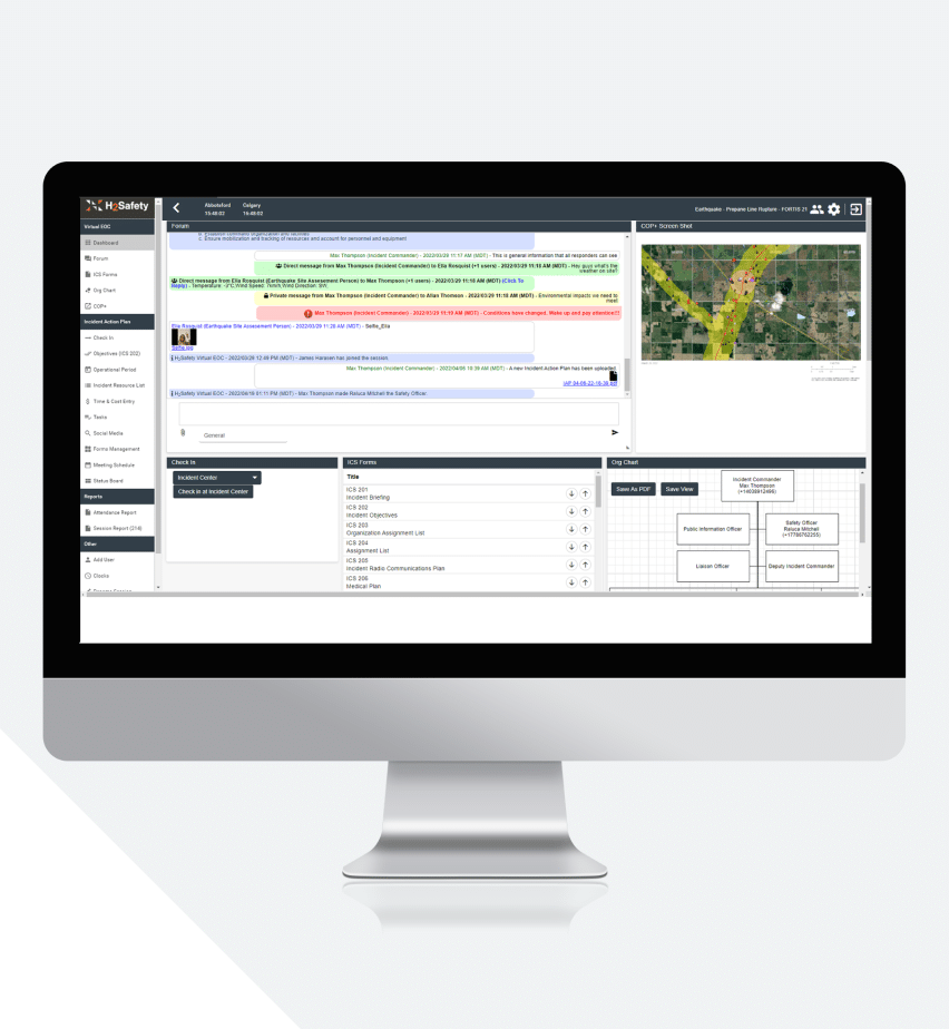
Virtual Emergency Operations Center (VEOC) Application allows you to activate your emergency response teams in an instant. The user-friendly dashboard facilitates seamless communication with your customized groups, ensuring the appropriate individuals support the incident. Allow responders to contribute and access critical information (pictures, ICS forms, and hazards). A cost-effective solution which unifies all responders and agencies involved. The VEOC App easily integrates with the Common Operating Picture Application (COP+). In tandem, they deliver a complete overview of the incident for your team, enabling effortless incident management.

Popular Features

Logo of Microsoft PowerPoint, a software solution featuring a white 'P' on an orange background with three horizontal lines to the right, symbolizing a presentation slide.

IAP

Effortlessly create Incident Action Plans via the intuitive IAP Application. Access, leverage, and manage ICS forms and documents, and customize response tools with ease. Streamline virtual and in-person check-ins. Efficiently track resources, costs, and schedule meetings. Utilize the electronic status board to enhance situational awareness and integrate social media monitoring to add depth to your response strategy. Overall, the IAP app simplifies Incident Command Systems, allowing you to focus on the response, not the software.

Popular Features

Computer screen displaying a complex GIS (geographic information system) software solutions interface with multiple windows and tools for spatial data analysis.
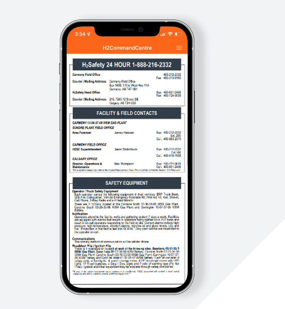
A smartphone displaying a detailed emergency management contact list on its screen, showing various phone numbers and addresses.
Icon depicting a bound document or report with text lines and a spiral binding on a blue background, symbolizing software solutions.

E-ERP

Utilize the Electronic Emergency Response Plan (E-ERP) Application on any device, smartphone, or tablet to access critical response plans worldwide. Information is always up to date via automatic updates and is available to all personnel securely. Your hassle-free document management tool hosts essential documents (Safety Bulletins, HSE Manuals, and company-specific forms) to access instantly during emergencies. Simplify your binder management by upgrading to electronic documentation management within the E-ERP app today.

Popular Features

Icon of a calendar on a purple background with a speech bubble, suggesting software solutions for scheduling or appointments.

NOTIFY

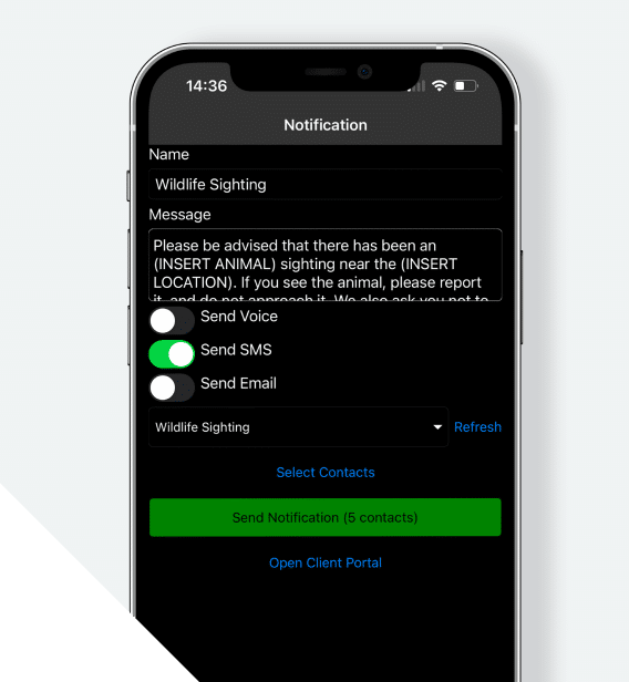
Reliable mass notification module Notify stands out in emergency and non-emergency scenarios. Providing seamless communication via phone, SMS, and email to your selected contact groups, when it matters most. Ideal for schools, municipalities, and industry-agnostic. Alert your community and residents of weather warnings, first shooter alerts, building closures, or water advisories. The robust module offers templated notifications and scheduled alert capabilities you can depend on. Rely on Notify to simplify your communication efforts efficiently across complex settings. Learn more about how others are using Notify today.

Popular Features

Hand holding a smartphone displaying a wildlife sighting report app with options to send SMS, email, and refresh the page for emergency software services.
A computer monitor displaying a geographic response plan software solution with multiple data entries and sidebar navigation options.
Icon depicting a location pin with a biohazard symbol, set against a dark background, representing software solutions.

GRP

The Geographic Response Plan (GRP) Application elevates control point management categorized by region and waterbody. GRP facilitates efficient asset searches, both textually and geographically, enhancing overall responsiveness. Accessible on any device, your team will benefit from real-time updates, user-friendly interactive maps, secure data storage, and optimized emergency response capabilities – streamlining your operations. Discover GRP’s proactive and responsive approach to geographical response planning.

Popular Features

A simple icon of the earth depicted on a blue square background, representing software solutions.

COP+

The Common Operating Picture (COP+) Application is user-friendly emergency management within a sophisticated cloud-based app, fully integrated with GIS Systems and offering an intuitive interface to access critical company data along with the ability to generate comprehensive COPs. Accessible on all devices, smartphones, and tablets, your team will define emergency planning zones, manage ICS requirements, automatically gather response information, pinpoint all stakeholders within specific areas, post notifications, and utilize dispatch capabilities. Additionally, COP+ offers five robust modules: Respond, Wildfire, Spill, Asset, and Ice for more complex emergency management.

Popular Features

A construction worker in a reflective vest studies software solutions on a laptop displaying a map with geographic data, in a busy workspace.
A red square icon with a white shield and exclamation mark in the center, conveying emergency response management.

respond

A software solutions farmer in a hat talking on a cellphone in a green field at sunset.
Emergency planning symbol on a red background.

Wildfire

Nighttime forest fire engulfing trees, with intense flames and glowing embers visible through the forest underbrush, necessitating emergency response management.
Icon of a water drop above a puddle, depicted in white on a purple square background for emergency management.

spill

Blue ocean water intercepted by bright yellow emergency response barriers, viewed from above.
Icon depicting one person connected to two cars, representing a concept of shared vehicle ownership or usage in emergency management.

Asset

A white pickup truck labeled "hazsafety software solutions" parked near an operating oil pump jack under a cloudy sky.
A simple blue square icon depicting a white iceberg and a mountain reflected in water, symbolizing emergency management.

ICE

A panoramic view of a bright blue glacier with jagged peaks, surrounded by icy waters against a clear sky, ideal for studying through emergency management software solutions.

WE EXIST TO
PROTECT

H2Safety has prioritized your safety for over 20 years. You can count on us to support your Emergency Response Management and Development through excellent customer service and innovative software applications.

Contact us today to get started!

20+

Years of Experience

10+

Industries We Protect

3000+

Satisfied Clients